File:Map of Europe (political).png
Original file (1,596 × 1,043 pixels, file size: 86 KB, MIME type: image/png)
.png)
The revision #19707 of the page named "File:Map of Europe (political).png" does not exist.
This is usually caused by following an outdated history link to a page that has been deleted. Details can be found in the deletion log.
.png)

|
This map has been uploaded by Electionworld from en.wikipedia.org to enable the |
Summary
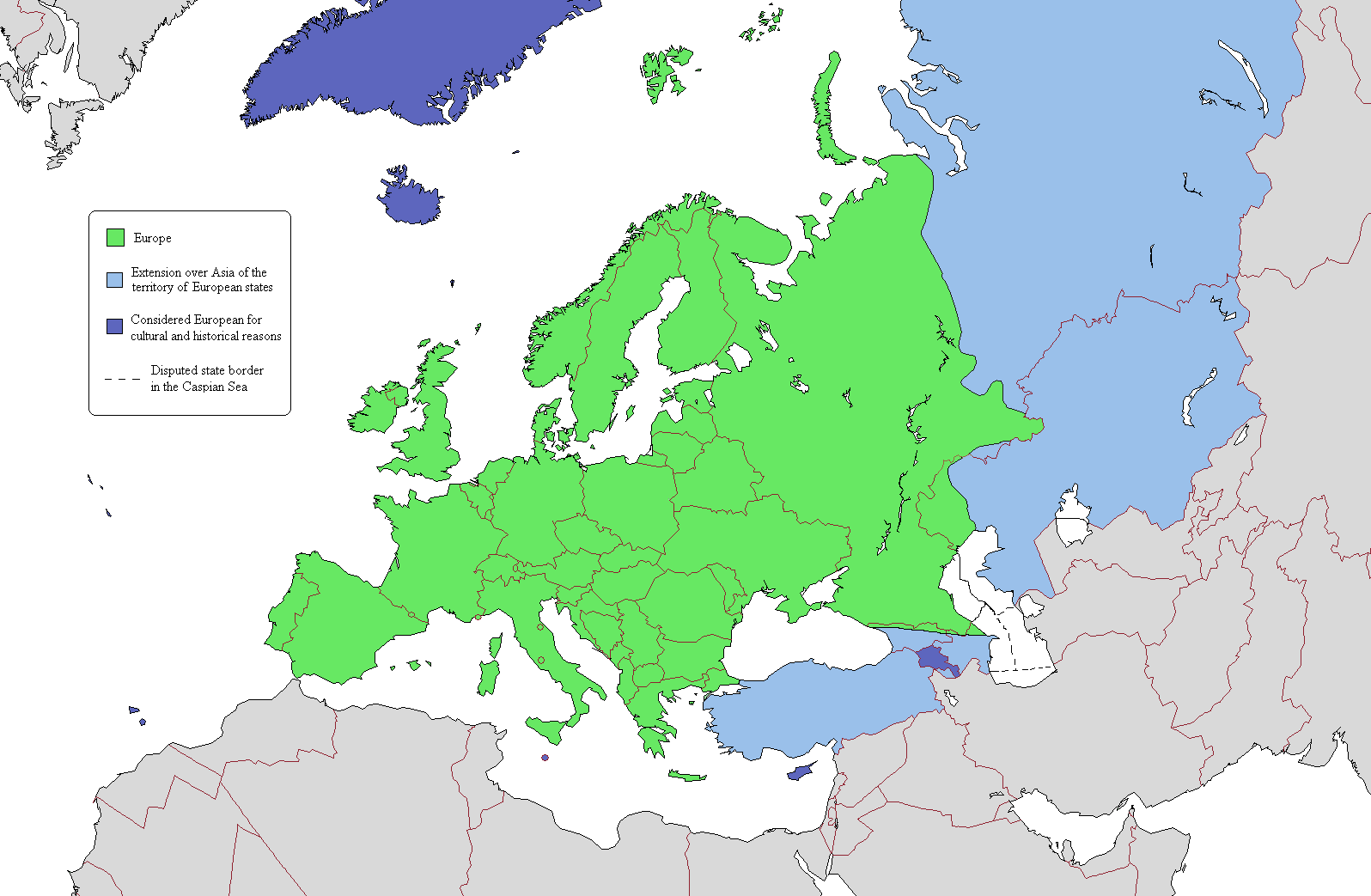
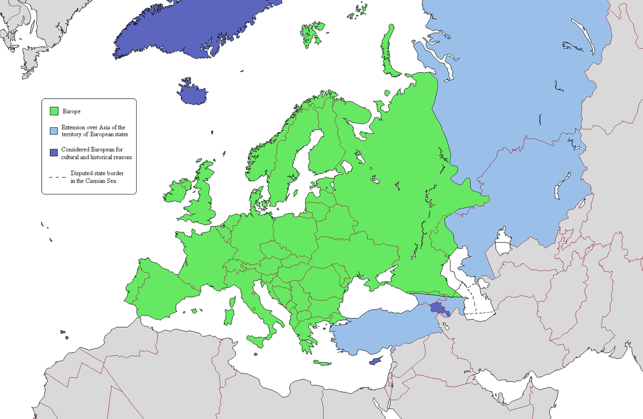
This is a map intended to show the continental boundary of Europe, and the territory of transcontinental states. The map is flawed in a number of ways, and a corrected version is found at [[: File:Europe Asia transcontinental.png]]. Since the latter is a derived version of this one, a copy of the flawed map should be kept around for licencing reasons. The original map appears to have been uploaded to Wikipedia in 2006 by en:User:Alinor.
Derivative works of this file: Europe Asia transcontinental.png
Derivative works of this file: Map of Europe 2007 (political) de.png
_de.png)

|
This map image could be re-created using vector graphics as an SVG file. This has several advantages; see Commons:Media for cleanup for more information. If an SVG form of this image is available, please upload it and afterwards replace this template with
{{vector version available|new image name}}.
It is recommended to name the SVG file “Map of Europe (political).svg”—then the template Vector version available (or Vva) does not need the new image name parameter. |
Licensing

|
Permission is granted to copy, distribute and/or modify this document under the terms of the GNU Free Documentation License, Version 1.2 or any later version published by the Free Software Foundation; with no Invariant Sections, no Front-Cover Texts, and no Back-Cover Texts. A copy of the license is included in the section entitled GNU Free Documentation License. |
| This file is licensed under the Creative Commons Attribution-Share Alike 3.0 Unported license. | ||
| ||
| This licensing tag was added to this file as part of the GFDL licensing update. |
File history
Click on a date/time to view the file as it appeared at that time.
| Date/Time | Thumbnail | Dimensions | User | Comment | |
|---|---|---|---|---|---|
| current | 17:03, 20 June 2019 | | 1,596 × 1,043 (86 KB) | Rs4815 | Border in the south-east passes along the Greater Caucasus Range |
File usage
The following page uses this file:
.png&oldid=19707)