File:Downtown Detroit Street Circuit.svg
Jump to navigation
Jump to search


Size of this PNG preview of this SVG file: 800 × 543 pixels. Other resolutions: 320 × 217 pixels | 640 × 435 pixels | 1,024 × 696 pixels | 1,280 × 870 pixels | 1,553 × 1,055 pixels.
Original file (SVG file, nominally 1,553 × 1,055 pixels, file size: 232 KB)
Summary
| Description |
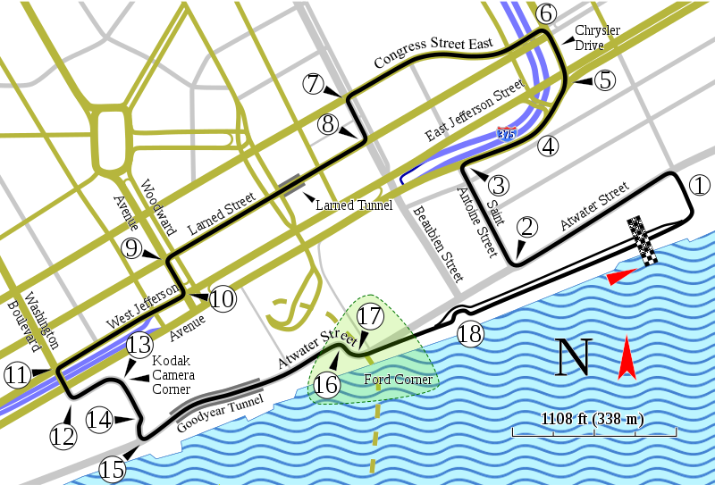
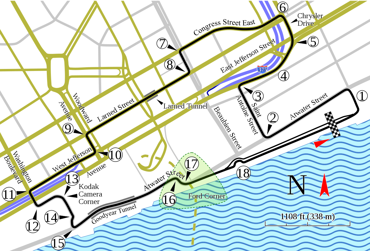
English: Track map of the former downtown Detroit street circuit. (Don't confuse this circuit with the one on Belle Isle.) |
| Date | |
| Source | Own work; Source for course information: "1982 F1 US Grand Prix of Detroit report: Watson takes victory". Motor Sport (July 1982): 43. Retrieved on 28 October 2019. |
| Author | Will Pittenger |
| Other versions |
|

| Camera location | | View this and other nearby images on: OpenStreetMap |
|---|
Licensing
This file is licensed under the Creative Commons Attribution-Share Alike 3.0 Unported license.
- You are free:
- to share – to copy, distribute and transmit the work
- to remix – to adapt the work
- Under the following conditions:
- attribution – You must give appropriate credit, provide a link to the license, and indicate if changes were made. You may do so in any reasonable manner, but not in any way that suggests the licensor endorses you or your use.
- share alike – If you remix, transform, or build upon the material, you must distribute your contributions under the same or compatible license as the original.
File history
Click on a date/time to view the file as it appeared at that time.
| Date/Time | Thumbnail | Dimensions | User | Comment | |
|---|---|---|---|---|---|
| current | 10:56, 17 January 2016 | | 1,553 × 1,055 (232 KB) | Soisyc Croisic | Fixed Atwater street name |
File usage
There are no pages that use this file.